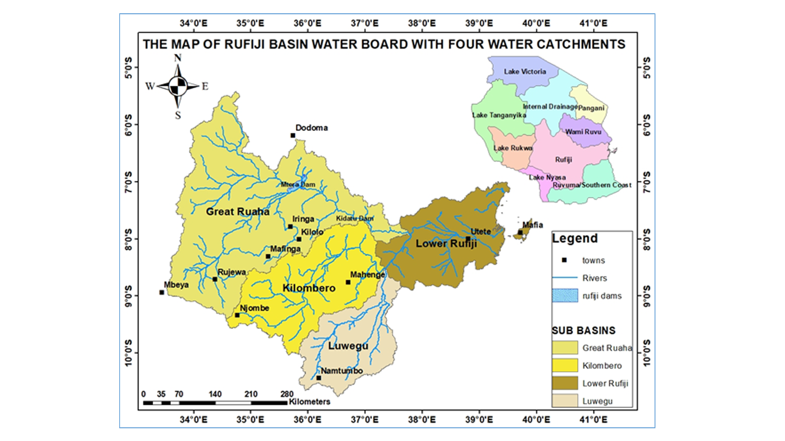
Bodi ya Maji ya Bonde la Rufiji (RBWB) ilianzishwa mwaka 1993 chini ya Sheria ya Matumizi ya Maji (Udhibiti na Usimamizi) Na. 42 ya mwaka 1974 pamoja na marekebisho yake yaliyofuata. Sheria hii ilifutwa na kubadilishwa na Sheria ya Usimamizi wa Rasilimali za Maji Na. 11 ya mwaka 2009 ikufuatiwa na marekebisho ya Sheria ya Usimamizi wa Rasilimali za Maji Namba 8 ya mwaka 2022. Bonde hili linahusisha eneo la kilomita za mraba 183,791 (takriban 20% ya Tanzania Bara). Mto Rufiji hutiririsha maji kuelekea Bahari ya Hindi. Bonde hili liko kati ya Longitudo 33o55’E na 39o25’E na kati ya Latitudo 5o35’S na 10o45’S. Kwa kuwa mipaka ya Bonde hili haifuati mipaka ya kiutawala, mikoa kumi na moja inahusishwa, ambayo ni Iringa (Mkoa ambao eneo lake lote lipo ndani ya Bonde la Rufiji), na mikoa mingine ambayo inapitiwa kwa sehemu ni Mbeya, Dodoma, Singida, Tabora, Morogoro, Ruvuma, Njombe, Lindi, Dar Es Salaam na Pwani.
Tazama ramani ya maeneo yaliyopo ndani ya Bodi ya Maji Bonde la Rufiji